 |
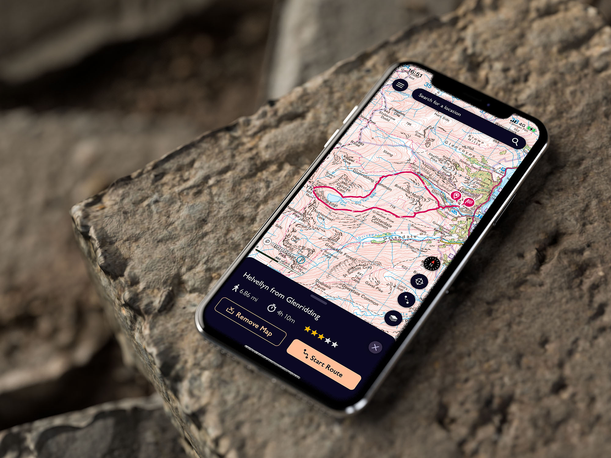
| The OS Map App is the perfect way to discover new walking routes, plan walks and download maps to your phone to stay on track even when you have no signal. |
OS Maps App - review of the Ordnance Survey Phone Map App with subscription
I've been hiking well over 20 years and when I first started out it was a case of using paper maps (unless you could afford the very expensive GPS devices). Technology has moved on a lot and now there are quite a few good value Map Apps you can download direct to your phone. I've tried a few over the years and have settled on OS Maps as my phone application of choice and I think the annual subscription is one of my best investments a walker can make. Read on to discover exactly what I like about the Ordnance Survey Phone Map App for walking (you can of course also use it for running & cycling!)
 |
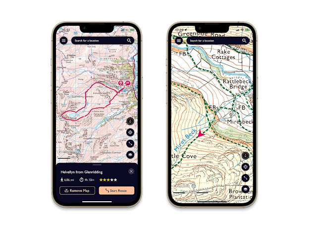
| Downloading OS Map routes to your phone is really easy, and seeing where you are on the route with no phone signal is very very useful! |
What I love about OS Maps App (with subscription):
- The OS Maps App uses the familiar and detailed Ordnance Survey maps, with unlimited use of every OS Explorer and OS Landranger map for the whole of Great Britain. That’s instant access to 607 maps to view, print, or download to your phone with your subscription. That's really good value in my eyes and well worth a couple of quid a month
- You can discover walking routes by other users in a given geographical area (just zoom in on an area and see walking route ideas pop up!) You can then save and download these walking routes to your phone. This makes it really easy to discover new walks. You can also import GPX files from others.
- You can also plot your own OS Map routes on your computer, tablet or direct on your phone (it's by far the best Map App to do this on your phone, with a snap to path feature making it easy to plan long walking routes with relatively few clicks/screen taps). You can then save these plotted OS Map routes and it will show you total distance, elevation and estimated walking time.
- Once OS Map routes are downloaded to phone you can use them anywhere, even with no phone signal as it uses global GPS to show you where you are on the route. This is a superb feature of downloaded Phone Map Apps and comes in really handy as usually in the countryside phone signal is rubbish or non-existent - but that's not an issue. It means you can see exactly where you are on the saved OS Map route and know which direction and paths to take at various junctions. Quite a few times I’ve inadvertently taken a wrong path - but checked my phone after 50m or so and realised the error and got back on track. This makes it almost impossible to get lost haha
- You can also print out your OS Map routes (worth doing as a back up just incased your phone runs out of battery or you damage your phone - the obvious concern when using phone map apps)
- When logged into OS Maps on your desktop computer/laptop you can even view OS Maps in 3D and as fly through to give you an idea of the terrain (as flat maps even with contour lines and height indicators can be deceiving). The 3D view also gives you an idea of views you will encounter on your walk, especially important for planning photographs and discovering the best view points.
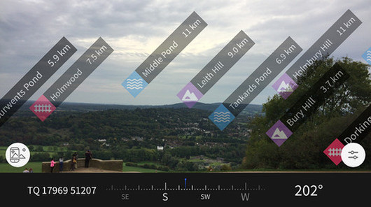
- The augmented reality feature when used out on your phone alms is a nifty bit of technology too as lets you learn about the landscape and learn summit names and the distance of what’s close by.
 |
| The 3D view is really excellent feature of OS Maps that lets you get a good understanding of the terrain of a particular walking route and you can virtually fly around the landscapes |
Any negatives about the OS Maps App?
I really can't think of any negatives about the OS Map App, some may say paying a subscription fee - but for £28 or so a year I certainly get my monies worth on all the walks I do from it and it’s a good value investment.
The walking pursuits will say you shouldn't rely solely on Phone Map Apps, and that's true to an extent, but with OS Maps you can also easily print your routes as a back-ups, and I do recommend learning how to use paper maps with a compass. That being said, I do think Phone Map Apps help more people get out into the great outdoors and discover new walking routes with the increased confidence that they won't get lost and for me that is a good thing.
OS Maps App Summary:
I’ve tried quite a few Phone Map Apps over the years and I have settled on using OS Maps and paying the annual subscription - which is due to the range of features, excellent usability on all devices and it’s good value. If your looking for a Phone Map App then I really would recommend OS Maps.
Find out more about OS Maps & subscribe:
The OS Maps App can be downloaded to your phone for free, but available map types & features are limited, and you can't download route maps to your phone to use on your walks. I really do recommend subscribing to view all map types and be able to plot your own routes. You can subscribe monthly or annually, but as ever the the annual subscription works out better better, and for what works out a couple of quid a month - what's not to like?
Simply click the banner below to find out a more about OS Maps on the Ordnance Survey website, where you can also subscribe and download the App:
 |
OS Maps App FAQ:
Is OS Maps Free?
You can download the App for free and view routes, such as those shared on this blog, but the choice of maps available and features is limited. I really do recommend subscribing to access the full range of features and more detailed maps
Is it worth subscribing to OS Maps?
If you are a keen walker then definitely yes. For just over £2 a month you get access to all OS Maps to the whole of Great Britain and can use all features of OS Maps. That’s instant access to 607 maps to view, print, or download to your phone with your subscription. It will open up a world of possibilities for walking and it's honestly the best investment I've made in my hiking hobby (other than my walking boots haha)
Happy Hiking!

Post by Stuart Hodgson 'The Hiking Photographer'

Subscribe to my monthly email newsletter to stay up to date with all my outdoor adventures, including my latest photos & walking blog posts, as well as a whole host of tips & interesting stuff for outdoor enthusiasts, just click the link below to subscribe.
FOLLOW ME
Not all my adventures & photos end up on this blog -
Give me a follow to see what else I've been up to!
 |
| A useful blog post on recommended essential walking gear |


No comments
Post a Comment
Thanks for taking an interest in my blog, all comments and questions are welcome! Best, Stuart