Yorkshire Three Peaks Challenge walk - essential info & tips learned from our Yorkshire Three Peaks experience
The Yorkshire 3 Peaks walk is a fantastic must-do challenge for any experienced walker to tick off the list and a great day out for a group of people and it's one of the best challenges me and my mates have done together. The full walking route is 25 miles and the popular challenge is to try and do the full walk in under 12 hours. The distance is twice as long as my previous longest walk and would be the furthest my feet had carried me in a day. I wasn’t too sure how it would go, if I’d enjoy it all and if my legs would carry me that far haha. But having now completed it - the walk was a great challenge, didn’t seem as long as I thought it would and I really enjoyed the full day. Don’t get me wrong my legs where weary after about the 20 mile mark - but I felt a lot better than I expected. We completed the full route in a total time of 9 hours 40 minutes and having done so I now have a few bits of essential info to share that might be useful to you if your planning your own Yorkshire 3 Peaks Challenge.
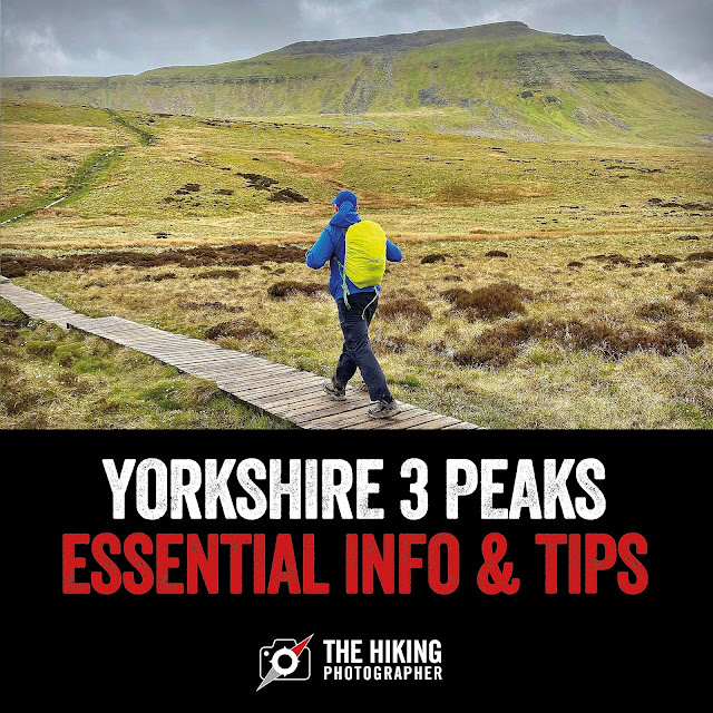 |
| Read on for the common Yorkshire 3 Peaks questions answered and my essential tips to help you plan well for your walk |
3 Peaks Yorkshire - common questions:
How long does it take to walk the 3 Peaks in Yorkshire?
The popular challenge is to walk the Yorkshire 3 Peaks in under 12 hours. Most experienced walkers with good fitness should be able to do it in 10-12 hours. When I did it we weren't walking exceptionally fast - just normal pace with maybe 4/5 10 min stops and it took us 9 hours and 40 minutes.
How far is the 3 Peaks in Yorkshire?
The Yorkshire Three Peaks is 25 miles on the best, most popular walking route, as shown on the map below.
Is the Yorkshire 3 Peaks hard?
The Yorkshire 3 Peaks is not to be taken lightly - you'll be walking a marathon distance for around 12 hours and the combined ascent is more than 1,800m, which is greater than Ben Nevis, the UK's tallest mountain at 1,345m.
Which of the Yorkshire 3 Peaks is the hardest?
Pen-Y-Ghent (694m) is the steepest peak if you walk it from the south and you'll need to use your hands and scramble (I found this the hardest). Whernside is the tallest at 736m but it seemed the easiest if you go up the more gentler path from the east and I'd say Ingleborough (723m) was the second toughest. It can be subjective though - and perhaps for many the hardest is the last peak they do :-)
 |
| Pen-Y-Ghent above is the smallest in height of the 3 Peaks - but the most challenging. It's best walked up on the steepest south side (pictured right above) and walk down the more gradual way. |
Yorkshire Three Peaks - tips from my experience:
What direction should you walk the Yorkshire Three Peaks?
The best direction to walk the Yorkshire Three Peaks is in an anti-clockwise direction, no matter where you start from. The means you will go up each Peak the optimum way and come down a better route. On each peak we climbed I was pleased we went up & down the way we did. On Pen-Y-Ghent in particular I think it’s best to go up the steeper southern section and come down the more gradual way (otherwise you’ll be coming down on your bum a lot :-) Also Whernside & Ingleborough seems easier to walk to their summit if you go in the anti-clockwise route.
If you don't have a Phone Map App - I really recommend the one by Ordnance Survey. You can download the Yorkshire Three Peaks map route featured in this page to your phone and the app will show you exactly where you are when walking the route even when you have no signal - so no taking a wrong turn :-)
 |
Where should you start your Yorkshire Three Peaks walk?
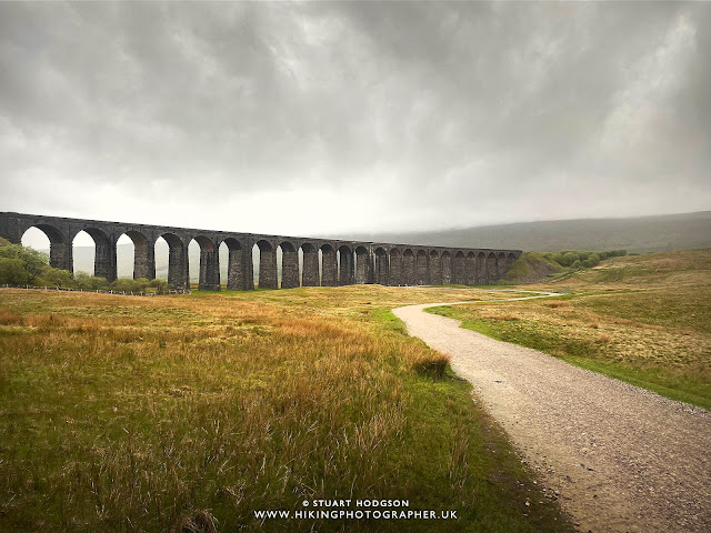
The most popular place to start the Yorkshire Three Peaks walk is from Horton-in-Ribblesdale - this is because traditionally people would clock-in/out at the Pen-Y-Ghent cafe, which is sadly now closed [May 2022]. Most big charity group challenges also start from Horton-in-Ribblesdale. However I would recommend starting from near the Ribblehead Viaduct. There is plenty of free parking and it means you stay ahead of the Horton-in-Ribblesdale crowds if you do this walk on a weekend in the warmer months. If you walk the recommended anti-clockwise direction, you'll tackle Whernside first (tallest), then Ingleborough and then Pen-Y-Ghent last, with a nice flat-ish walk back of just over 7 miles. You’ve also got the option of getting the train from Horton-in-Ribblesdale to Ribblehead if you’ve bitten off more than you can chew!
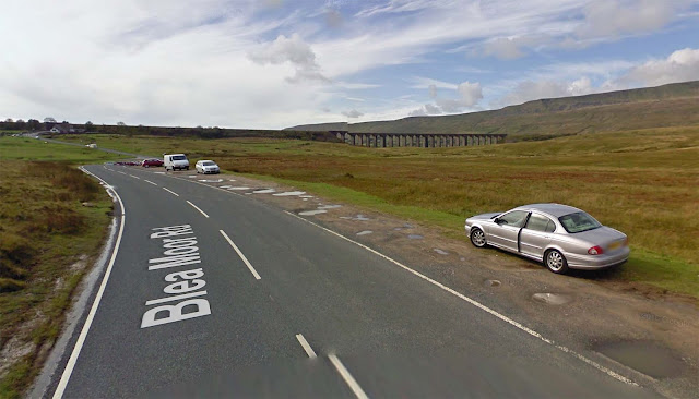 |
| There is plenty of free car parking spaces on the roadside around Ribblehead Viaduct - which makes for a good place to start the Yorkshire Three Peaks walk |
When is the best time to do the Yorkshire Three Peaks?
It’s a very popular walk and on most weekends in good weather in spring/summer/autumn there will be lots of people doing it. Unless you are in a big charity event then I’d suggest doing it when these events are not on if you want a bit more of a quieter walk. Mon-Fri is also a good time to do it. The walk can take up to 14 hours so you’ll want plenty of daylight hours too so the best months are mid April - mid Sept.
How much water should you take on the Yorkshire Three Peaks?
In typical UK temps, 3-4 litres of water should get you through the walk. You don't need to carry the full amount of water you need though, as you can refill on route. The best and most welcome place to refill is at Philpin farm (Chapel-le-dale, after Whernside) - where they have a roofed barn to sit down and fill your bottles from their free drinking water tap. There's also a vending machine here for hot & cold drinks (and toilets). There's sometimes a mobile cafe at Ribblehead to buy drinks, and there's a pub near here (Station Inn). At Horton-in-Ribblesdale, which is quite a small, the Pen-Y-Ghent cafe is now sadly closed, but there's a small local post-office to buy refreshments (not open all the time as we found out) and a pub also which is your best bet. You'll also find public toilets here. On my 3 Peaks walk (cloudy day) I took 2 x 750ml water bottles which I refilled once at Philpin Farm and also a couple of small bottles of lucozade. Depending on the time of year you do the walk and what sounds most appealing as a summit treat, you might also want to take a flask of warm coffee or a chilled icey drink. It’s also a good idea to have a nice drink waiting for you in the car at the finish.
What toilets are there en-route on the Yorkshire Three Peaks?
If your desperate for a toilet stop, you'll find the most accessible ones at Philpin Farm Barn (Chapel-le-dale, near Whernside) and public toilets in Horton-in-Ribblesdale. There's also the Station Inn Pub (Ribblehead) but it would be common courtesy to buy something while your there.
What food should you take on the Yorkshire Three Peaks?
I'd recommend taking all your food with you. There are places you could buy food from (same places where you could refill your water) but don't rely on them. Your food is your fuel for the day, so high-carbs is the name of the game. Have a high-carb tea the night before (eg.pasta), a good breakfast (porridge etc). Also use the travel time to the start of the walk to get some good energy onboard. To take on demanding walks I personally like peanut-butter bagels, bananas, sandwiches, cereal bars, jaffa cakes, nuts, chocolate bars as a treat, and it's also a good idea to take a bag of sweets (jelly babies, fruit pastilles etc) for mini-treats and instant energy at the bottom of each peak, as well as energy gels etc.
What footwear should you wear on the Yorkshire Three Peaks?
First and foremost wear footwear that you have walked in before over many miles and are broken in. The Yorkshire Three Peaks is not a walk to try out brand new footwear (or footwear you’ve only used a couple of times) or you will end up with blisters which will make your walk much more difficult and painful. It can be done in Trail running type shoes as the path is well marked most of the walk and either gravel or stone slabs. Waterproof footwear is a must though if rain is forecast. One of my best tips: Take 1 or 2 extra pairs of socks and change them on or just after each peak. Your feet will sweat on this long walk, making your socks damp and moisture makes blisters more likely to form - so try and keep your feet dry. Even give your feet a bit of fresh air when you stop if the weather is good. One of our group had only done a couple of walks in their new footwear and ended up with the worst blisters I had seen - he some hoe powered on though. Someone else in our group forgot their walking boots lol - but managed it in trainers (which weren’t in the best of states by the end of it :-)
What clothes shall I take on the Yorkshire Three Peaks?
You'll want to walk in specialist walking t-shirts that dry quickly (not cotton), and depending on the temperatures you'll wear walking trousers or shorts. If rain is forecast then take your waterproofs and take an extra layer for the summits as it's often blowy and much cooler up on the summits when you stop. A cap will help keep the sun off (if warm) and a beanie will keep your head warm if temperatures are at the low end. Gloves may also come in useful depending on time of the year - mine did on the summits in May!
Other recommended items to take when doing the the Yorkshire Three Peaks?
- Walking poles may come in handy for the summit descents, especially if your knee's aren't what they used to be!
- Plasters might come in handy as blisters are a common occurrence over 25 miles of walking.
- Take a head-torch if you are doing this walk at the time of year when days are shorter - just incase it takes longer than you think or there’s any injuries or sudden mobility issues.
- You'll be on the walk for 10-14 hours - and a phone battery power bank might help keep your phone in use (important if you are using your phone for directions - bare in mind the signal is poor or non-existent on a lot of the walk)
- Route Maps - to keep you on the right track - make sure you have the Yorkshire 3 Peaks route downloaded to your smart watch or phone (to work without phone/internet signal as you won't get signal on much of this route) Also take a paper map as a back up as you never know! The paths are pretty clear though.
How much training should you do for the Yorkshire Three Peaks?
This walk is only for reasonably fit, experienced walkers. You'll want to get some miles on your feet before you do it, so make sure you get a few long walks under your belt before (at least 10 miles) and some with steep hills in them. The max distance some in our group done before the Yorkshire Three Peaks challenge though was a 15 mile walk, and my personal training plan, well didn't go to plan. I done a few steeper walks in the Lake District mountains, but didn't have the time to get any walks in over 10 miles. I do run though on a regular basis so a few 5k weekly runs kept my fitness levels up and I used the gym to try and get my leg muscles prepped. I'd say the key is to get your fitness up, not necessarily by doing long flat easy walks - but anything that gets you out of breath, improves your cardio fitness and gets them leg muscles in good shape and ready for the ascents and descents. So think steep shorter walks, running, spinning classes and the gym for leg conditioning. If you can walk 15 miles, the buzz of the day will carry you through the extra 10 miles.
Yorkshire Three Peaks - photos of our walk [May 13th 2022]
So now you know a bit more about the Yorkshire Three Peaks challenge based on my experience and here's some photos of our little rabbles experience. We done the full walk in 9 hours & 40 minutes (inc stops) so not too bad eh!
 |
| Here is our gang - all 10 of us and some carrying a bit of extra weight (and I'm not talking about the bags haha) |
Yorkshire Three Peaks - our walk overview:
Yorkshire Three Peaks Walk Distance: 25 miles
Yorkshire Three Peaks Walk Time: 9 hours 40 minutes
Yorkshire Three Peaks Difficulty: Hard!
Ribblehead to Whernside - Yorkshire Three Peaks route:
Whernside to Ingleborough - Yorkshire Three Peaks route:
 |
| One Yorkshire Peak down and now onto the next one! |
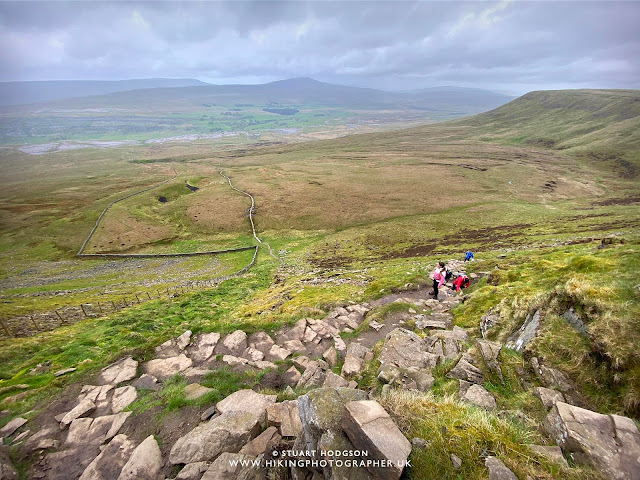 |
| The ascent of Ingleborough - this section zig zags up as it's quite steep - so you'll probs want to take a few stops to "admire the views" |
 |
| The summit top of Ingelborough is quite expansive and very open to the elements. What this photo doesn't show is the very windy conditions which was right in our faces. |
Ingleborough to Pen-y-Ghent - Yorkshire Three Peaks route:
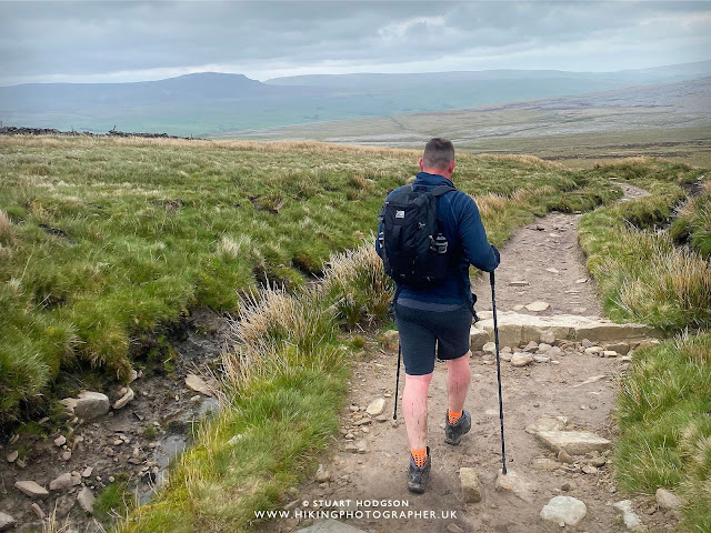 |
| Onwards we walk to Horton-in-Ribblesdale, with Pen-Y-Ghent in the far distance |
 |
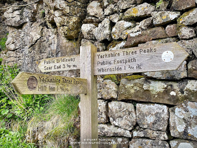
| There's quite a few signs about to keep you on track - as pointed out here by Mossy |
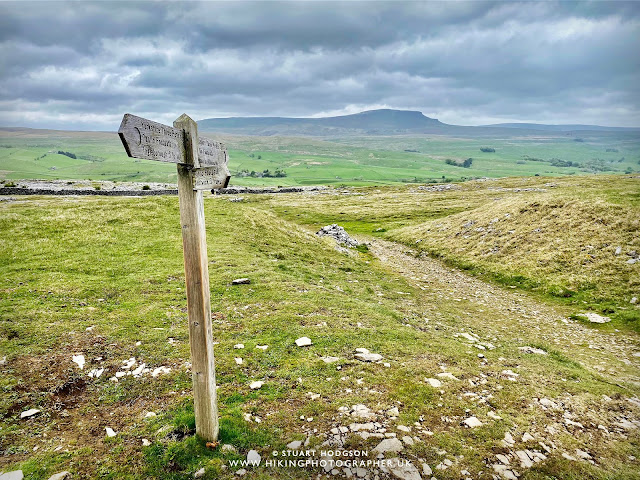 |
| The distinctive summit of Pen-Y-Ghent is straight ahead and visible all the way from Ingleborough |
 |
| The walk leads us next to Horton-in-Ribblesdale |
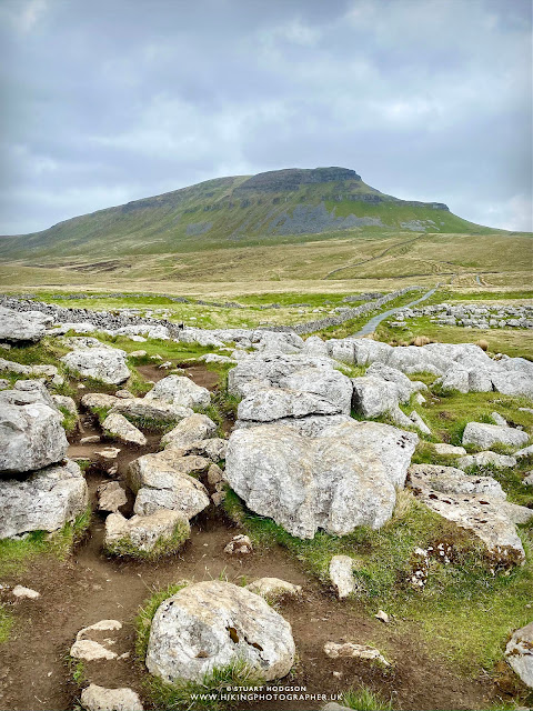 |
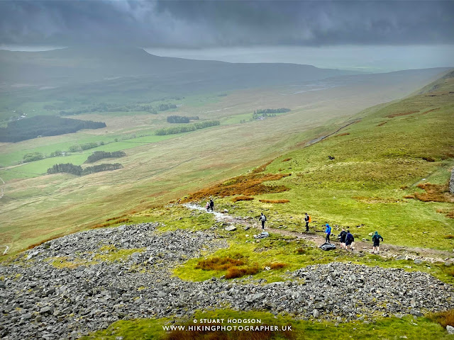
| Onwards to Pen-Y-Ghent- the third and final of our Yorkshire Three Peaks. We'll walk up the steep section (pictured right) and descend the more gradual route on the left. |
 |
| This route up to the summit of Pen-Y-Ghent is the steepest section on the entire Yorkshire Three Peaks route |
Pen-y-Ghent to Ribblehead - Yorkshire Three Peaks route:
 |
| The last section of this route is on the roadside for about 30 mins and spirits are high that we have nearly completed the Yorkshire Three Peaks walking challenge. |
And there you are. I hope this blog post has helped in shedding some light on the Yorkshire Three Peaks walking challenge. It was a great unknown to us before we did it, and whilst there are websites out there with information, we still had a few questions and weren't exactly sure what to expect on the route. I'd definitely recommend it to anyone who is into walking and wants a good challenge. It got us lot fitter in training for it and it's one of the best days walking we've had. After the walk we all stayed the night in Hawes which is a 10 min drive away and has a few pubs for food & drink - so makes for a good place to stay, have a few beers and a laugh and take the strain off the legs. My legs where certainly stiff after the pub and the next day, but within a couple of days we where already planning the next walking challenge..
Happy Hiking!

Post by Stuart Hodgson 'The Hiking Photographer'

Subscribe to my monthly email newsletter to stay up to date with all my outdoor adventures, including my latest photos & walking blog posts, as well as a whole host of tips & interesting stuff for outdoor enthusiasts, just click the link below to subscribe.
FOLLOW ME
Not all my adventures & photos end up on this blog -
Give me a follow to see what else I've been up to!
SHOW SOME LOVE!
If you've found this blog post useful, show some appreciation with a donation.








No comments
Post a Comment
Thanks for taking an interest in my blog, all comments and questions are welcome! Best, Stuart