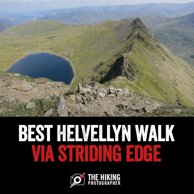
Helvellyn walk via Striding Edge & Swirral Edge. One of the best walks in the Lake District and this is the must-do route
Helvellyn is the most popular walk in the Lake District in terms of number of people who walk it every year and whilst it's not higher than Scafell Pike, I think it's a much better and more exhilarating walk. This is due to the ridge route of Striding Edge, which may look imposing but it's a great challenge (and perfectly safe in good weather conditions if you take care). I also like to descend via Swirral Edge, another ridge that may require you to use your hand sin parts. This Helvellyn walk makes for a great day out and a good walking accomplishment that any serious hiker needs to tick off the list. Below are some answers to the popular questions on planning a Helvellyn walk, followed by some photos of this particular Helvellyn route to give you a flavour of what to expect!
How high is Helvellyn?
Helvellyn is 950m in height and is the 3rd highest mountain in England after Scafell Pike (978m) and Sca Fell (964m).
How long does it take to walk Helvellyn?
The full walk takes around 4-5 hours depending on the route and the recommended route is via Striding Edge as shown on this blog post. There are different ways back down and Swirral Edge is a great way to descend.How many miles is Helvellyn walk?
Again it depends on the route but the most popular Helvellyn walks are around 7 miles in length, whether form Glenridding or Patterdale.Is Helvellyn Ok for beginners?
While Striding Edge can look imposing - in good, dry weather conditions the walk is ok for beginners if you have a reasonable level of fitness and don't mind using your hands on occasions to scramble the summit. Beware though it can be dangerous on Striding Edge in wet or winter conditions. |
| Read on to discover the best Helvellyn walking route via Striding Edge in my humble opinion. |
Helvellyn Striding Edge & Swirral Edge walk overview:
Helvellyn striding edge walk Distance: 6.9 miles
Helvellyn striding edge walk time: 4 hours 45 mins
Walk Difficulty: Hard
There's some scrambling involved with hands. Different routes can be taken along Striding Edge depending on the challenge wanted (ie. you can walk to the side of the ridge line for less exposure). The route is fine in good weather conditions for reasonably fit walkers (inc. older children). But beware of doing the Helvellyn route in rain and especially icy/snow conditions - when it becomes very difficult requiring crampons/ice-axe.
Helvellyn walk route map:
If you don't have a Phone Map App - I really recommend the one by Ordnance Survey. You can download route maps to your phone such as this one and the app will show you exactly where you are on the route even when you have no signal - so no more taking a wrong turn :-)
 |
Photos of what to expect on this Helvellyn walk route:
 |
| From the main road we follow the lane towards Grsidedale and The Kennels. |
 |
| Looking up towards Patterdale Common and the Grisedale Valley with Nethermost Pike in the far distance. |
 |
| We now begin the long hike up towards the 'Hole in the Wall' |
 |
| Glorious sunshine and views today up the Grisedale Valley |
 |
| It's going to take us about an hour to walk up Patterdale Common towards the 'Hole in the Wall' |
 |
| Nethermost Pike and Dollywagon Pike in the distance. |
 |
| En route to Hole-in-the-Wall and Striding Edge and its all uphill in this section of the Helvellyn walk |
 |
| Looking up Grisedale Valley |
 |
| The 'Hole in the Wall' isn't far off now and we've said we will rest, drink & eat when we get there :-) |
 |
| It is a bit of a slog up this section of the walk - but for me once this section is done and you get to the 'Hole in the Wall' - the worst of it is over and it's a lot more enjoyable. |
 |
| Looking back down to where we have come form |
 |
| The 'Hole in the wall' - it's not a cash machine :-) Quite a few people where taking a rest around here - it's the perfect place to stop - fuel up and get ready for Striding Edge. |
 |
| Now we can see Red Tarn - and a few people are swimming in there already on this glorious day. |
 |
| Us lot making our way across the top of the Striding Edge ridge line with Helvellyn in the distance |
 |
| Looking back along Striding Edge - you can see the easier and quicker path to the left of the ridge line clearly in this pic. |
 |
| Other walkers on Striding Edge |
 |
| Red Tarn next to Striding Edge |
 |
| Pose Scott :) |
 |
| As you get closer to the summit of Helvellyn the rocky scree turns to grass and it's much easier going |
 |
| We've done the hard part now and it's pretty level up here! This is looking south along the Helvellyn range to Nethermost Pike. |
 |
| Looking back to the many visitors up here today. Usually it's quite windy up here - so the walls where some walkers are sat today offers much needed shelter - but today it doesn't matter. |
 |
| Swirral Edge is much easier going that Striding Edge and shorter and it's soon out the way |
 |
| Looking back at the route we have just taken via Swirral Edge, and then it's back to the Hole in the Wall |
 |
| We are back on familiar territory as we walked up this route earlier - and it's much easier and quicker to get back down :-) |
 |
| And there we have it - the walk approaches it's end. We get down into Grisedale Valley near the Kennels - and head back along the lane to Patterdale Hall and a much needed drink :-) |
I hope you have enjoyed that little write up - and that it inspires you to want to give this Helvellyn walk via Striding Edge and Swirral Edge a go your self! Be warned it's not always sunny like this though :-) This was maybe my 6th visit to Helvellyn and I've never had clear weather like it - luck of the draw I guess. If you have any questions about this route - just post a comment and I'll try and answer.
Before I go you should not underestimate this walk and changing weather conditions and multiple wrong turns you can take. If you don't have a Phone Map App - I really recommend the one by Ordnance Survey. You can download route maps to your phone such as this one and the app will show you exactly where you are on the route even when you have no signal - so no more taking a wrong turn :-)
Before I go you should not underestimate this walk and changing weather conditions and multiple wrong turns you can take. If you don't have a Phone Map App - I really recommend the one by Ordnance Survey. You can download route maps to your phone such as this one and the app will show you exactly where you are on the route even when you have no signal - so no more taking a wrong turn :-)
 |
Happy Hiking!

Post by Stuart Hodgson 'The Hiking Photographer'

Subscribe to my monthly email newsletter to stay up to date with all my outdoor adventures, including my latest photos & walking blog posts, as well as a whole host of tips & interesting stuff for outdoor enthusiasts, just click the link below to subscribe.
FOLLOW ME
Not all my adventures & photos end up on this blog -
Give me a follow to see what else I've been up to!
 |
| Help support this blog and buy some unique greeting cards or landscape prints by Stuart Hodgson (The Hiking Photographer) - visit www.hikingphotographer.bigcartel.com |
 |
| A useful blog post on recommended essential walking gear |


No comments
Post a Comment
Thanks for taking an interest in my blog, all comments and questions are welcome! Best, Stuart