 |
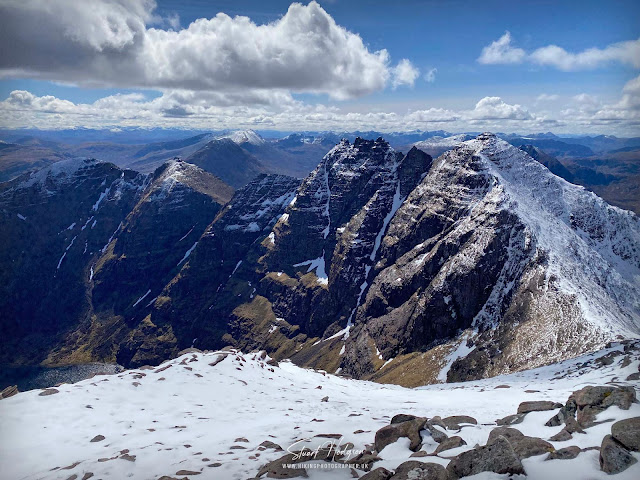
| The imposing An Teallach mountain ridge taken from just below the summit of Bidein Galas Thull - the best view point along the full ridge in my humble opinion |
An Teallach walk, one of the finest mountain ridges in the whole of the UK
An Teallach in Scotland is a spectacular mountain range renowned for its rugged beauty and challenging terrain. Situated in the remote and wild northwest Scottish Highlands, the imposing An Teallach range offers a thrilling and demanding adventure for seasoned hikers and mountaineers. The name "An Teallach" translates to "The Anvil" in Gaelic, reflecting the formidable nature of the peaks and ridges that comprise this majestic landscape.
An Teallach is not one mountain summit, but a series of peaks, towering pinnacles, knife-edge arêtes, and steep gullies, providing a thrilling and exposed traverse for those daring enough to attempt it. The panoramic views from the ridge are nothing short of breathtaking, encompassing the surrounding mountains, glens, and lochs. An Teallach is a true gem for those seeking an exhilarating and awe-inspiring mountain experience in the heart of Scotland's untamed wilderness.
An Teallach - one that's been on the bucket-list for a while
I'd had An Teallach on my list to tackle for a very long time, after reading many times it being referenced as one of the finest mountains in the UK, and the photos I'd seen of An Teallach looked incredible and dramatic. I finally found the time to head up to North-West Scotland in April with a couple of mates on a Scottish road-trip, staying first in Inverness, then making the 1.5 hour drive to An Teallach to complete the walk, then staying in Ullapool for other adventures.
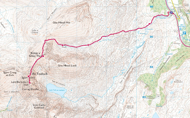
We had the An Teallach route planned out after a bit of research online, which you can see in the below map. We planned to tackle it in a clockwise direction, as we had learned that this direction was possible without specialist climbing equipment (easier going up and down the likes of the Corrag Bhuidhe Pinnacles in a clockwise direction, and very difficult and precarious going the other way in an anti-lockwise direction) However, we were also aware of the so-called by-pass or "chicken-run" route which avoided the ridge tops if the conditions weren't favourable. We figured we would just see how it felt once up there before deciding to go up on the knife-edge ridge tops.
An Teallach Map Route
An Teallach Walk Distance: 9.5 miles
An Teallach Walk Time: 6 hours
An Teallach Walk Difficulty: Difficult/Exposed
Abort mission, go for 'Plan B' An Teallach Route!
This is where the usual blog process of here's the map and here's the photos of the experience stops, as in the end we didn't do the route shown above, due to some unexpected snow after a snow free period and not wanting to take risks on an unknown route. At the time I was gutted we didn't do the route as planned, and that I wouldn't be able to complete and share the full An Teallach experience on this blog, but I think what actually did happen might help some of you thinking of walking An Teallach route!
 |
| On the early drive to An Teallach - and found that some unexpected fresh snow had laid up on the peaks despite being snow free for a week or so before! |
AN TEALLACH - SNOW JOKE!
Because of the fresh snow we weren't prepared and not everyone had brought crampons or spikes and having not been up An Teallach before - we weren't familiar with the route or exact paths and unsure of how easy the by-pass paths would be to find in the snow, and knew how precarious An Teallach could be even in good conditions.
So we decided to go for a Plan B route and instead tackle the route above in an anti-clockwise direction as we knew from online research that heading up to the Munroes of Bidein Galas Thull and Sgurr Fiona via Galas Tholl was less precarious and more straightforward forward hiking, rather than scrambling over dangerous Pinnacles or trying to by-pass them, and I knew the best views of An Teallach could be witnessed from these Munroes (as shown in the photo at the top of the page). So we thought we could at least tick 2 Munroes off and then assess the situation and seek out the so-called "chicken-run" route that would avoid the precarious Corrag Bhuidhe Pinnacles. In the end I'm glad we did do this - as we discovered that due to the snow, and lack of other people being up there that day - the actual by-pass routes could not be found due to being hidden by the the snow coverage. We did advance and managed to get up close to Lord Berkleys Seat - but after that we couldn't locate the by-pass / chicken-run path and knew that the Corrag Bhuidhe Pinnacles shouldn't be tackled in an anti-clockwise direction so we did the sensible thing and simply retraced our steps.
AN TEALLACH - A LESSON TO SHARE
The lesson I wish to share here - if you aren't familiar with the An Teallach route - is that if there is snow kicking around up top (even a light dusting - possible in spring & autumn) - it makes way finding a lot more difficult and potentially dangerous. So if you are not that confident of tackling An Teallach either due to experience or bad weather (even rain or wind) - I suggest doing the simpler, there and back route below - to tick off the 2 Munroes and see that impressive and the best view of the An Teallach mountain range shown at the top of the page. I know its not ideal, but it's a good plan B.
An Teallach Route - Plan B!
An Teallach Walk Distance: 8.5 miles
An Teallach Walk Time: 5 hours
An Teallach Walk Difficulty: Hard
If you don't have a Phone Map App - I really recommend the one by Ordnance Survey. You can download route maps to your phone such as this one and the app will show you exactly where you are on the route even when you have no signal - so no more taking a wrong turn :-)
 |
Photos of our 'fudged' An Teallach walk
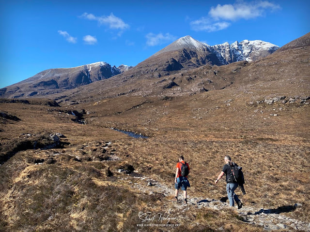 |
| The walk up towards Glas Tholl via Allt a' Ghlas Thuill was quite leisurely and well marked and basically tracked the small river and passed some nice small waterfalls |
 |
| The path then gets rather steep as you head up Glas Tholl towards the dip where the snowline is |
 |
| As we pass through the snowline it's full winter conditions, and it's a lot deeper than we thought it would be. Certainly a walk of 2 halves this one! |
 |
| Despite the snow it's actually fairly mild and the shorts can stay on as we head to the second Munroe of the day, which will involve a straightforward decent before heading back up |
 |
| Taking a moment to admire the An Teallach views before heading up the Ridgeline to the summit of Sgurr Fiona which stands at 1060m |
 |
| One of me and one for the memories! An Teallach must be one of the most impressive and dramatic mountains that I've seen in the UK |
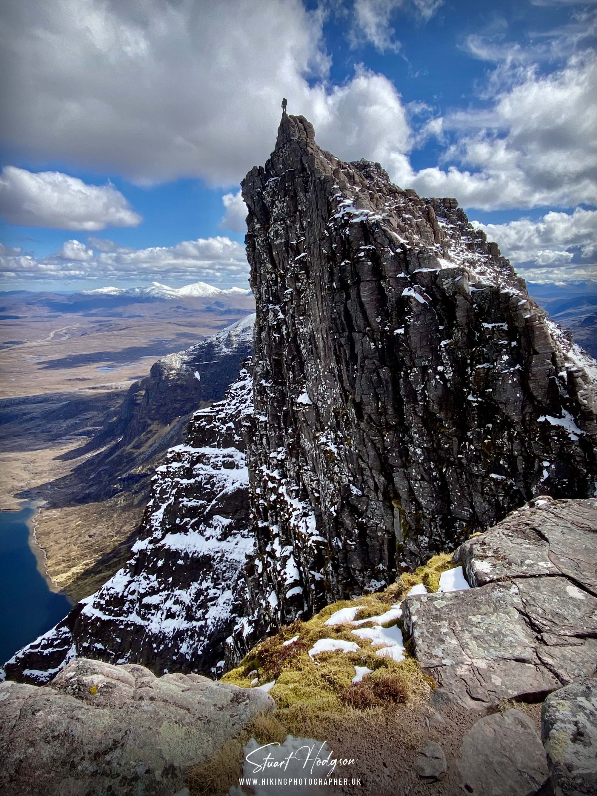
This point is where this walking route stops advancing, after Lord Berkleys Seat is the challenging rocky pinnacles of of Corrag Bhuidhe and you don't want to be tackling those in this direction even in good conditions. We had read of the by-pass route which misses out of Corrag Bhuidhe at the base of Lord Berkleys seat - but we couldn't make out any paths due to the snow. We did try and forge our own path - but there are quite a few steep drops so we didn't advance any further as who knows where we would have ended up! So we reluctantly, but wisely, retraced our steps back to the start.
USEFUL EXTERNAL LINKS
For those tackling An Teallach and want to do the full traverse and maybe use the by-pass route - here is a good post on the topic www.walkhighlands.co.uk/Forum/viewtopic.php - here is. You'll also see a good photo of the Corrag Bhuidhe by-pass route on this blog post https://highlanddrifter.com/an-teallach
Here is a good trip report and some excellent photos of what to expect on the full traverse https://getlostmountaineering.co.uk/walks.php?id=454
I'll be back to An Teallach!
It's not often I get the chance to venture this far up into North West Scotland, but I will definitely come back to hike An Teallach one day and do the full circular route as it's a very impressive, and challenging mountain.
I hope if you have stumbled across this blog post it helps you in planning your An Teallach adventure (and give you a good idea of what's in store, and a Plan B option haha) but definitely have a search around online to get a fuller picture of this impressive, and precarious mountain ridge.
Happy Hiking!

Post by Stuart Hodgson 'The Hiking Photographer'

I share my adventures as I love the outdoors and it's spectacular natural landscapes and want to help others get outdoors too. Being outside can also bring many physical and mental health benefits to us and I want others to reap these benefits too. I hope you enjoy the blog and it inspires you to plan a trip!
You can subscribe to my quarterly email newsletter, featuring my recent outdoor adventures, latest photos & blog posts, just click the link below!








No comments
Post a Comment
Thanks for taking an interest in my blog, all comments and questions are welcome! Best, Stuart