 |
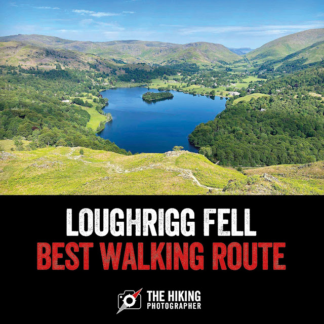
| Stunning views of Loughrigg Tarn from Loughrigg Fell with the Langdale Pikes in the distance. If there is one walk I'd recommend to do in the Lake District for people new to the area - this would be it |
Loughrigg Fell circular walk details:
This Loughrigg Fell walk is in my view, one of the best walks in the Lake District, as for it's relatively short distance and ascent, you get lots of varied and very impressive Lake District views
Distance: 5.19 miles
Time: 3.5 - 4 hours
Difficulty: Moderate
Map route of this Loughrigg Fell circular walk:
 |
| [Map: Click to enlarge] This walk starts from White Moss Car Park in between Grasmere & Rydal water. It's best done in an anti-clockwise direction, where you are straight into great views of Grasmere along Loughrigg Terrace and on the on the ascent to Loughrigg Fell summit. You'll then get some completely different and equally stunning views of Loughrigg Tarn and into into the Langdales. Then at the southern edge of Loughrigg Fell you'll get impressive views of Windermere and lovely views of Rydal Water on the final section. It's variety really do make it one of the best walks in the Lakes. There are a few paths up on Loughrigg Fell and I suggest viewing the full route via the link below to help in planning. (note you will need a subscription to view all map features) |
If you don't have a Phone Map App - I really recommend the one by Ordnance Survey. You can download route maps to your phone such as this one and the app will show you exactly where you are on the route even when you have no signal - so no more taking a wrong turn :-)
Is Loughrigg Fell an easy walk?
Loughrigg Fell is a modest 335 metres in height so it's not that difficult a walk. The only real challenge is the ascent from Loughrigg Terrace on this particular route where you head up some usefully placed rocky steps. It is worth it though as the views are stunning and as good as the views you get on much bigger Lake District Summits.
How long does it take to climb Loughrigg Fell?
The shortest walking route is 2-3 hours - however to make the best of it to enjoy the variety of views I really recommend this route on this page which can be done in 3.5-4 hours
Is Loughrigg Fell a Wainwright?
Loughrigg Fell is a Wainwright and is one of the easier ones to summit. It's located between Ambleside, Grasmere and Skelwith Brdge and if you are in the Windermere area it is highly recommended especially if you are new to walking Wainwrights.
 |
| Read on to learn more about this brilliant Loughrigg Fell walking route |
Photos of what to expect on this Loughrigg Fell walk (My best Lake District walk in the Ambleside / Windermere area):
 |
| At the very start we head over the beck from White Moss Car Park, where it will cost you around £5 for a few hours parking (machine takes a bank card and there are also toilet facilities here) |
 |
| White Moss wood is a lovely little woodland to walk through to get warmed up |
 |
| As we climb the little hill to Loughrigg Terrace we get a glimpse of Rydal Water - which we will return past later. The weather is beautiful today - nice and sunny - perfect for some great views - and this walk has plenty of them in all directions! |
 |
| A glimpse of Loughrigg Fell and we take a right here to Loughrigg Terrace - later we will come back from the path on the left |
 |
| The path along Loughrigg Terrace come into view |
 |
| Loughrigg Terrace gives stunning views of Grasmere |
 |
| Grasmere looks amazing from up here and it's a nice place to stop on one of the few benches on Loughrigg Terrace and soak it all up |
 |
| Heading up the steps to Loughrigg Fell - this is the steepest part of the walk and you will want to take many opportunities to "admire the view" / take a breather :-) |
 |
| Grasmere from higher up - what a day for one of the Lake Districts best views! |
 |
| The last view of Grasmere as we approach the summit of Loughrigg Fell |
 |
| Still a bit to go to reach the actual summit of Loughrigg Fell! |
 |
| You get some really nice views into the Langdale valley up here too |
 |
| Made it - the summit and the first view of Windermere |
 |
| On the summit looking towards the Langdales |
 |
| Looking at the path we've just care up with Grasmere poking through in the distance |
 |
| You can also see Elterwater from up here |
 |
| On the decent the path to take is to the left on the cairn - the more well-market path to take |
 |
| Th path is pretty easy to follow throughout this walk |
 |
| You'll get some amazing views of Loughrigg Tarn on this walk also - as you can imagine this place also looks beautiful in the autumn! |
 |
| Heading towards Windermere |
 |
| Stopping to again admire the views of Loughrigg Tarn - absolutely stunning |
 |
| As long as you stick to the well-defined paths you can't get lost up here |
 |
| The stone walls in the Lake District are a thing to admire - so much time must have went into their construction |
 |
| I get a bit snap happy of Loughrigg Tarn with the Langdale Pikes in the distance - I love the composition of the view |
 |
| I decide to stay here a while, bask in the sun and admire the stunning views of Loughrigg Tarn from Loughrigg Fell with the Langdale Pikes in the distance |
 |
| You get the best views of Windermere from Ivy Crag and its another great place to stop |
 |
| Quite a few paths intersect here so be mindful to choose the right one! On this walk we turn left |
 |
| Heading downhill now to Rydal Water |
 |
| It's nice and sheltered on this section the walk next to Fox Ghyll and the quietest part - I don't pass anyone here |
 |
| The bridge over Fox Ghyll |
 |
| Bonus - there's an ice-cream van at Pelter Bridge :-) |
 |
| The path now heads towards Rydal Water |
 |
| A chance to enjoy another stop on the shores of Rydal Water |
 |
| Once on Rydal Water - take the path that leaves the shoreline path towards the disused quarries as there're some old caves there that you can explore |
 |
| Cave 1! |
 |
| Cave 2 - you can actually go into this cave at Rydal Water |
 |
| It's pretty big in here |
 |
| Its now a leisurely stroll back down to White Moss Woods |
 |
| The walk finishes where it started - White Moss Woods :-) |
Video: Loughrigg Fell circular walk
If you are interested in seeing a short interactive video of the route and where certain photos where taken - have a look of the video below:
As ever I hope you have enjoyed this little write up and photos and it inspires you to want to visit the area and give the route a go. If you have any questions about this route - just post a comment and I'll try and answer.
As I've mentioned, if you don't have a Phone Map App - I really recommend downloading the one by Ordnance Survey, especially if you are new to walking so you won't get lost! You can plan walks and download the maps to your phone and it will show you exactly where you are on the route even when you have no internet signal! (It works off your phones inbuilt GPS)
Happy Hiking!
Post by Stuart Hodgson
'The Hiking Photographer'
Subscribe to my monthly email newsletter to stay up to date with all my outdoor adventures, including my latest photos & walking blog posts, as well as a whole host of tips & interesting stuff for outdoor enthusiasts, just click the link below to subscribe.
FOLLOW ME
Not all my adventures & photos end up on this blog -
Give me a follow to see what else I've been up to!


This is a great blog post on the walk of Loughrigg Fell in the Lake District. Your photos are spot on too, and show off the walk to the top so well. And who doesn't love an ice-cream during a good walk on a sunny day in the Lakes. Great read and love the route that you took, certainly on the best.
ReplyDeleteThanks for dropping by - Loughrigg Fell is certainly hard to beat!
ReplyDelete